Formation
The wetlands lie between latitudes 22⁰25′ to 22⁰40′ North and longitudes 88⁰20′ to 88⁰35′ East, approximately. It has a hot and humid monsoonal climate that is governed by the Himalayan Mountain in the north, the Meghalaya plateau in the northeast, and the proximity to the Bay of Bengal. January is the coolest month, with temperatures generally ranging between 17⁰C and 21⁰C, while May experiences the years maximum temperature and range between 29⁰C and 33⁰C. The average relative humidity is high, being between 70% and 90% approximately. Relative humidity remains high in July and August. The average annual rainfall is about 1582 mm and is mainly concentrated in the months of June, July, August and September.
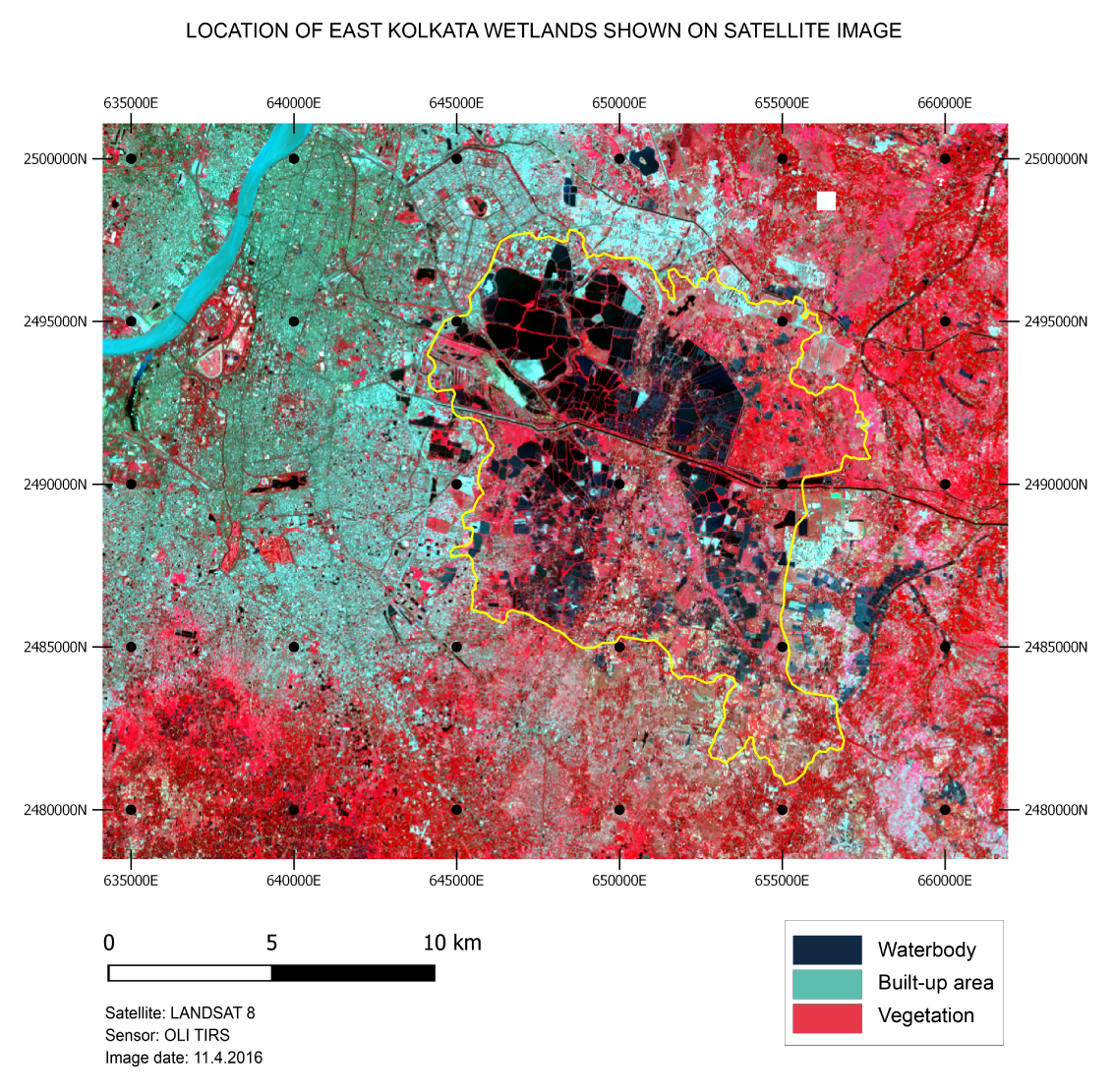
This region is a part of the mature delta of the River Ganges, and the wetlands are the ‛interdistributary’ marshes in the delta. Here the streams — which are distributaries and re-distributaries of the Ganges were once active. But with the shifting of the main river, these streams became inactive and some of them even died with loss of headwaters. While some of them were still building up land on both sides, between those raised tracts the land was depressed comparatively, being deprived of the annual deposition of silt (Bagchi, 1944). The study area is located in such a low-lying region to the east of Kolkata. It was once covered with salt water marshes. These salt water marshes were between River Hugli to the west, which is the main distributary of the River Ganga and the Bidyadhari River, now degenerated, to the east.
The mouths of some of the streams opened directly into the Bay of Bengal and were influenced by tidal action, which accounted for the tidal action and salinity of these salt water lakes in the vicinity of Kolkata. These lakes were actually the spill-reservoirs of the tidal channel Bidyadhari, which opened into the Bay of Bengal through the River Matla (Calcutta Municipal Gazette, 1924-25). One of the spill-channels of the Bidyadhari, the Central Lake Channel, extended practically into the heart of the city even until early in the present century, and was a main drainage-line for the city (Calcutta Municipal Gazette, 1929).
[Ref.- Bagchi, K. (1944). Stages in formation of Ganges Delta. Pp. 50-71 in The Ganges Delta. University of Calcutta, Calcutta, India: x+157pp., illustr.]
[Next Page: Wastewater Flow]